// 2026-05-14 · Maps & Exploration · by Bob Smith
Flightradar24: Watch Every Plane in the Sky, Live
Flightradar24 shows nearly every aircraft currently flying on one live map, routes, altitude, aircraft type and where that plane over your house is going.
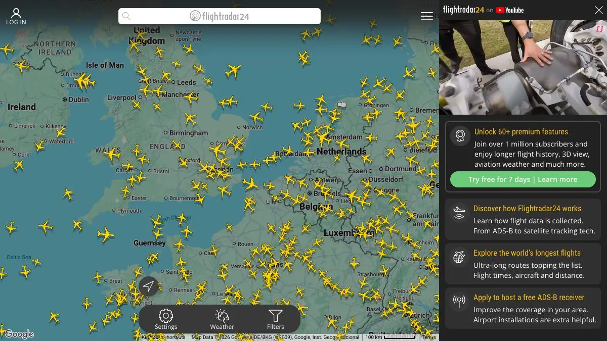
Flightradar24 is a live map of the sky. Nearly every aircraft currently flying, moving in real time, each one clickable for its route, altitude, speed and aircraft type. That plane droning over your roof right now? Twenty seconds and you know it is a Boeing 787 halfway from Doha to Manchester at 38,000 feet.
Open it once and you understand instantly why people lose whole afternoons to it.
What is Flightradar24?
It works because of ADS-B. Modern aircraft continuously broadcast their identity and position on an open radio frequency, and thousands of volunteers around the world run small receivers that catch those broadcasts and feed them in. Add satellite-based receivers for oceans and empty places, and you get a map that covers most of the planet most of the time.
The result on Flightradar24 is a screen crawling with little yellow planes. Zoom into Heathrow at 7am and it looks like an ant colony with a schedule. Zoom out over the Atlantic and you see the tracks funnel into neat parallel lanes, because that is genuinely how the North Atlantic is organized.
The details are the addictive part. Every aircraft carries a permanent registration, so you are not just watching “a flight”, you are watching a specific airframe that was built in 2011 and has been shuttling between the same two cities ever since.
What can you do on Flightradar24?
- Click any plane in the air. Flight number, airline, origin, destination, altitude, ground speed, heading, aircraft model, registration, and how much of the route is done.
- Follow a specific flight. Track a friend’s plane from pushback to landing, including the holding patterns nobody enjoys.
- Switch to 3D view. Drop into a cockpit-style view of the aircraft’s actual position and watch the terrain slide past beneath it.
- Look up airports. Live arrivals and departures boards, plus delay statistics and which runways are in use.
- Filter the map. Show only one airline, one aircraft type, or a specific altitude band. Hunting for the last flying examples of an old airframe is a real hobby and this is the tool for it.
- Watch the weird flights. Survey aircraft flying perfect grids, air ambulances, government jets, aircraft flying enormous circles for no obvious reason.
Tips to get the most out of it
Filter by aircraft type to go spotting from your desk. Type an ICAO code like A388 or B748 into the filter and the map shows only those. Suddenly you know exactly when the big one is coming.
Use the airport view before you drive to the airport. Live arrivals with actual positions beat the terminal board, which is often optimistic to the point of fiction.
Look for the holding stacks. When weather backs an airport up, aircraft fly lazy ovals nearby. Watching a stack build up over a major hub is oddly beautiful and explains your delay better than any announcement.
Check the aircraft’s registration history. Individual airframes have their own pages with photos and past flights. It turns an anonymous dot into a machine with a biography.
Zoom out at night. Pull back to a whole continent and watch the daily rhythm, Europe emptying, North America filling, the long-haul flow following the terminator around the globe.
Try the 3D view on approach. Pick a flight ten minutes from landing and switch to 3D. You get a surprisingly convincing sense of what the crew is looking at.
If you like Flightradar24, also try…
- MarineTraffic: the same idea for ships. Slower, heavier, arguably even more relaxing.
- Windy: the weather those aircraft are flying through, animated and layerable.
- earth :: nullschool: the jet stream that makes eastbound flights so much faster, drawn on a spinning globe.
- Blitzortung Lightning Map: live lightning strikes, which is exactly what those planes are steering around.
Everything else in this genre is in our Maps & Exploration collection. Clear your evening.
Frequently asked questions
What is Flightradar24?
Flightradar24 is a live flight tracking map that shows aircraft moving in real time around the world. Click any plane and you get its flight number, route, altitude, speed, aircraft type and often the exact registration of the airframe. It is used by aviation professionals, plane spotters and anyone curious about the aircraft passing overhead.
Is Flightradar24 free?
Yes, the live map is free to use in a browser with no account. Free users see the great majority of flights and full aircraft details. Paid subscription tiers add things like longer playback history, extra data filters, weather overlays and an ad-free view.
How does Flightradar24 know where planes are?
Most aircraft broadcast their position, altitude and identity over ADS-B, an open radio signal. Flightradar24 collects those broadcasts through a large network of volunteer-run ground receivers and combines them with satellite-based ADS-B and other data sources to build the live map. Coverage is densest over land and busy air corridors.
Can I find out which plane just flew over my house?
Yes, that is the classic use. Open the map centered on your location, look for the aircraft passing overhead, and tap it for its flight, origin, destination and altitude. The mobile app also has an augmented reality mode where you point your phone at the sky and it labels the plane you are looking at.