// 2026-08-05 · Maps & Exploration · by Bob Smith
River Runner: Follow a Raindrop From Anywhere to the Sea
River Runner lets you drop a raindrop anywhere on Earth and fly along its exact path downstream, through every creek and river, all the way to the ocean.
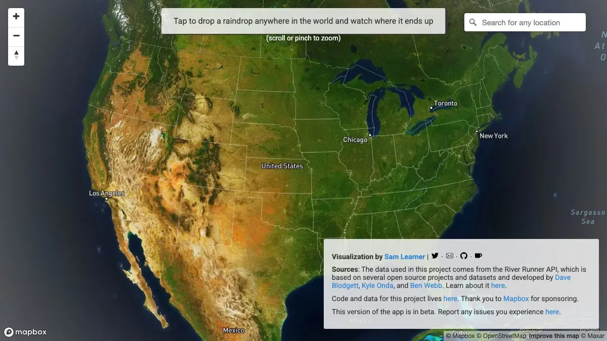
River Runner asks one question and answers it beautifully: if a raindrop landed exactly here, where would it end up? Click a hillside in Bolivia, a field in Poland, the parking lot outside your office, and the camera drops to ground level and starts flying downhill. Through a nameless gully, into a creek, into a river you have heard of, past cities, and eventually out into the ocean, several thousand kilometers later.
It takes about fifteen seconds to understand and considerably longer to stop.
What is River Runner?
The project comes from Sam Learner, who built the original United States version and then extended it globally. The mechanism is simple in description and quietly impressive in execution: take a point, look up the elevation model, work out which way water flows, follow that into the mapped river network, and keep following downstream links until you reach the sea. Then render the whole route as a continuous camera flight over terrain.
What makes it land emotionally rather than just technically is the naming. As you fly, the interface tells you what you are currently in. That is where the geography lesson happens. You did not know the stream behind your house has a name. You definitely did not know it joins something that joins something that turns out to be a major river four hundred kilometers away. Watersheds are one of those concepts that everyone nominally understands and almost nobody has any intuition for, and this fixes that in a single click.
The global version runs on worldwide elevation and river network data, which is a meaningful trade. The US original had access to extremely detailed national hydrography; the global model is coarser, and it shows in flat country, in deltas, and anywhere humans have rearranged the drainage with canals and pumps. Some paths will wander through a floodplain in a way no actual water does.
It also has a favorite failure mode worth seeking out deliberately. Drop a point in a closed basin, somewhere with no outlet to the sea at all, and watch what the model does with a route that has nowhere to go.
None of this undermines it. The point is not survey accuracy. The point is that water is connected, everywhere, in one enormous branching system, and this is the first thing most people have ever seen that makes that obvious.
What can you do with River Runner?
- Click anywhere on Earth. Any land point produces a path. The interesting ones are rarely the obvious ones.
- Watch the full flight. The camera follows the whole route at ground level, so you get terrain, valleys and the moment the water finally widens out.
- Read the waterway names. The overlay names each stream, river and lake as you pass through it, which is where most of the learning happens.
- Check the distance. Total path length is displayed, and the numbers are routinely absurd.
- Skip ahead. You can jump forward through the route rather than sitting through every meander of a long path.
- Share a specific run. The URL carries the starting point, so you can send someone the exact drop you found.
- Start from your own address. The most effective demonstration of the whole tool is doing it to the place you live.
Tips to get the most out of it
Start with your own house. Nothing else in the site hits as hard. Most people discover their roof drains into a river they could name but never connected to themselves.
Try continental interiors. Dropping a point deep in Siberia, central Africa or the Amazon basin produces flights long enough to make coffee during, and they are the best illustration of how big a watershed really is.
Find a divide and click both sides. Pick a mountain ridge, click one flank, then click a few hundred meters over the crest. Two nearly identical starting points, two completely different oceans. This is the single most instructive thing you can do with it.
Expect weirdness in flat and engineered places. Deltas, polders, irrigated plains and heavily canalized rivers are where the model struggles. That is a limitation of global elevation data, not a bug worth being annoyed about.
Let it run at full screen. It is a camera flight over terrain, and it is genuinely lovely at size. Shrunk into half a browser window it looks like a loading screen.
Use it as an argument. It is an unusually effective way to explain to someone why what goes into a storm drain matters, without saying a word about pollution.
If you like River Runner, also try…
- earth :: nullschool: the same idea applied to air and ocean currents, rendered on a spinning globe.
- Ventusky: watch the weather that produces the rain in the first place.
- The True Size Of: another map toy that corrects an intuition you did not know was wrong.
- ShadeMap: terrain and sunlight modeled over the real world, for a completely different reason.
The rest of our Maps & Exploration picks are similarly bad for finishing what you were doing.
Frequently asked questions
What is River Runner?
River Runner is a web map where you click any point on Earth and it traces the path water would take flowing downhill from there, then flies the camera along that route all the way to the sea. It shows the names of the creeks, rivers and lakes it passes through and the total distance traveled. It runs in a browser with no account or install.
Is River Runner free?
Yes, it is free to use and requires no signup. It was built by Sam Learner as a personal project on top of open hydrological datasets, and the code is publicly available.
How accurate is River Runner?
The paths come from real elevation and hydrography data, so the general route is realistic rather than invented. It is a model of downhill flow, though, so it can behave oddly in flat terrain, in heavily engineered landscapes, in endorheic basins with no outlet to the sea, and anywhere the underlying elevation data is coarse. Treat it as a very good approximation, not a survey.
Does River Runner work outside the United States?
Yes. The original version covered the United States using national hydrography data, and the global version extends it worldwide using global elevation and river network datasets. Coverage quality varies by region, since the global data is less detailed than the US-specific data it replaced.